A Walk Through the Past
by Roberta Skelton
A few weeks ago the local journalist Jean Murphy included in her column a call for people who remembered the original Central School to contact the Historical Society to reminisce about the building. One of the people who contacted the Society was Roberta Skelton, who had not only attended the school, but had also been one of the early members of Saint John’s Episcopal Church.
She had moved to Mount Prospect as a small child in 1935 and started first grade in the original Central School in 1937. The second Central School, or the Central Standard School, had been built about ten years earlier, but as the community grew the school district had run into space concerns again. As the original Central School was still standing on the same lot, it was pressed back into service and was used for the first grade for a number of years. Ms. Skelton remembered that the students would enter the building through the back door, a door that is still on the building, although no longer used. She also remembered her teacher, Miss Bloom, and that the first grade students did not sit at desks, but rather at tables. She confirmed what we had been told before, that the bell in the tower is from one of the last steam trains that traveled along the Chicago Northwestern tracks. She was able to flush the story out a bit more by remembering that the bell had been secured for the school by John Pohlman, the first station master in Mount Prospect and a good friend of William Busse who was responsible for the organization of School District 57 and the construction of the Central School. Ms. Skelton also talked about how the one room school was heated by a large, rectangular, wood burning stove at the front of the class, which was better than the pot bellied stove that had been their earlier. However, when the school was moved, the stove was removed and it was discovered that the stove had charred the floor boards and that the building had probably come within inches of burning down.
Ms. Skelton was one of the last students to go to school in the building. Shortly after she moved into the second grade the Central Standard School was expanded to hold all the students in Mount Prospect and the original Central School was sold to Saint John’s and moved. The original Central School was sold for $750, which even in that day was a pretty cheep. School District 57 sold it at this price with the understanding that the building would be moved off the property, very similar to the way the building was sold to the Mount Prospect Historical Society. A developer had given Saint John’s a lot to move the building onto and soon the move was under way. Saint John’s was a very small church at this time and could not afford an extensive renovation of the Central School building. When the building was moved, the vibrations caused all the plaster to crumble on the walls, so that when it arrived at its new home the walls were the naked lathe boards. For a time, Saint John’s covered the walls with burlap until they could raise the money to have the walls re-plastered. The church got by on what it had and a lot of dedication from the original members. The first pews for the church had been donated by other churches in the area and did not all match, while the alter was built by church members. Many other repairs to the building were done by church members.
The Central School became the first permanent home of Saint John’s Episcopal Church, although the Episcopal Women’s Guild of Mount Prospect had founded Saint John’s a couple years before they bought the Central School. They had been meeting temporarily in the VFW hall. When they moved into their permanent home, Ms. Skelton became the first child baptized in the permanent home of the church, making her both a first and a last for the building.
It was a pleasure speaking with Ms. Skelton, if any other members would like to come forward, please call the office.
The Homestead
Memories of the Meyn family buildings in the Downtown Triangle
by Betty Hodges Wooten
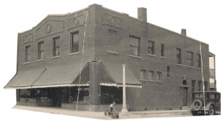
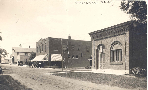
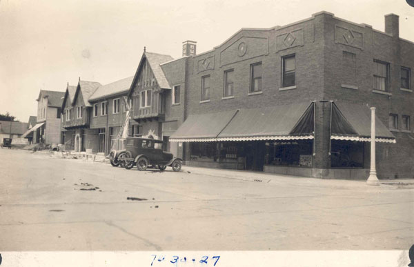
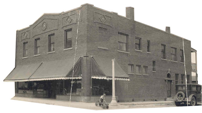
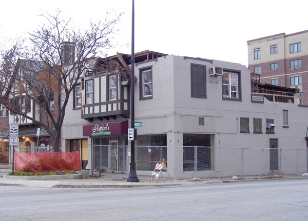
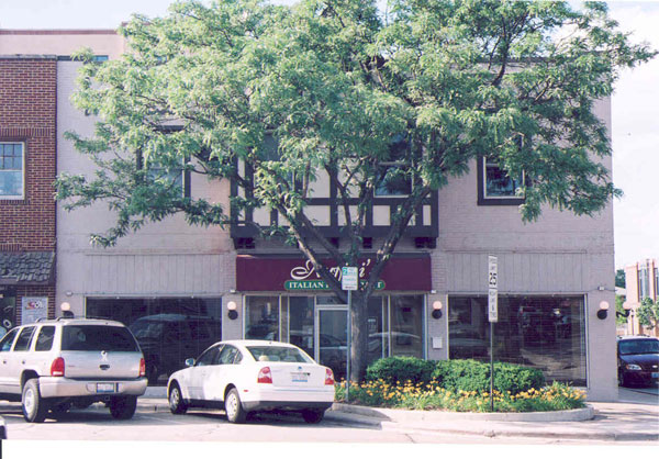
While talking to my cousin Delores on the phone today, I got some news from home that has sent memories racing through my mind. She told me that the ‘triangle’ in Mt. Prospect is due to be razed and there are already roped off areas around the original store and the “new building” on Busse Avenue. She does not know if Grandpa’s house is included in this demolition but we suspect it is. Most of the old towns along Northwest Highway have torn down the ancient buildings in their downtown areas and have replaced them with tall multiple family condominiums with businesses on the lower floor. This triangle of land which was first owned by John Moehling and sold to our grandfather to build his Blacksmith shop and home in about 1885, is now a prime area for high rise development. There is a restaurant on the point where the old shop stood, the two story house he built there in 1897 or ’98, the original barn which that was turned sideways to front on Busse Avenue and remodeled into a small store with living quarters upstairs, the two story building Uncle Bill and Aunt Martha built when Delores was about 7 years old in 1939, and a strip of small shops developed in the 1940 or ’50s.
We have long dreaded the demise of these buildings because in our mind’s eye, we see them as they were when we were children and just seeing them again, even though drastically changed, triggers many rich memories. I would like to walk you around this triangle as I see it in my memory. First, the Homestead was built in 1897 or 98. Before that, a small bungalow stood on this spot, the first family dwelling (not a farmhouse or business) built in Mt. Prospect. This house was built about 1885 for a cost of $350 by Grandpa John Meyn and the home he brought my grandmother, Christine Henningmeier, to when they were married on the 26th of April, 1886. This is where their first five children were born; Laura, Herman, Bertha, Elsie and William. By the time this 5th child arrived, it was time to build a larger home for their growing family and they moved the bungalow a block away to the East side of Main Street. It was used for many years as a schoolhouse, home, and finally a business until it was demolished in to make way for a parking lot in 1957.
About 1897, after William’s birth and the removal of the house, Grandpa engaged William Wille, a local carpenter and his crew to build the stately two story “Homestead” on that spot. I have recovered a picture of this house under construction with Grandpa standing in the front entry and the carpenters working on the roof and facia of the house. There are several young boys in the picture too, and I often wonder who they were. To the left of the house (west) the blacksmith shop stood. I believe the original building had been moved from the comer of Rt. 83 and Nw Hgwy to the western point of the triangle and another wing was added to make it larger. Behind the house was a two story barn which was later turned on the lot and remodeled into Bill and Martha Meyn’s first grocery store. Upstairs was a small apartment where they lived with their one child, Delores. The apartment was very small with a kitchen to the rear, a dining and living room, and one bedroom and bath. The picture of Martha behind the counter of this store is a treasure and you can clearly see some of the prices on the merchandise, a real time warp from today’s fare. Behind the store was a small wooden shed where Uncle Bill stored onions, potatoes, gunny sacks of nuts in the shell, etc. This small store and living area were soon outgrown and “new building” was erected one door to the east. This building had a full basement, a large grocery store with eating area and bathroom to the rear, an enclosed garage, and a lovely apartment upstairs. The rooms were large and sunny with two bedrooms, bath, a large living and dining room, a beautiful cabinet kitchen, back porch and stairwell to the downstairs both front and back. Notice I said cabinet kitchen. This was specified in those days because not all kitchens had cabinets on the walls. Most had pantries or free standing storage space in the kitchen. This is where Delores grew up and later lived with her own family after she was married. We both have so many memories of fun times in this sheltered area with family on almost every comer between her house and mine. It was a secure and special place in which to grow.
Behind this building on Busse Avenue and stretching to the Highway, was a yard that was located to the east side of Grandpa’s house. Along one side were grapevines and there were fruit trees in that yard with two large mulberry trees toward the street. The branches hung draped almost to the ground and Delores and I could hide under that tree and pick and eat mulberries to our heart’s content. Grandpa made wine from the grapes and mulberries and would serve it to his guests in his old red thumbprint wine glasses.
There were steps going up to a small porch at the front entry door of the homestead and inside the front door you came into a hallway with an open staircase to the left, and a hallway to the right with a colored glass doorway leading into the living areas. There was a mirrored hall tree there at the entrance for hats and umbrellas. Actually, through the years as the family married and grew smaller, the house was used as a two apartment dwelling and since Grandpa lived in the upstairs quarters while I was growing up, I have few recollections of the downstairs. But as I remember it, through the glassed doorway you walked into a large dining room with a bay built on the east side. This has two windows on the wide part and one window at a 45 degree angle to either side so it is an actual walk-in bay window area. Opposite the bay, I believe I remember a built in china cabinet. To the right of the windows were oak pocket doors leading into what was a living room. Mother remembered these doors were kept closed during the week and opened only for special occasions or on Sunday. To the rear was a bedroom which was used by my grandparents, and I believe a bath was added later.
Through another doorway from the dining area you walked into a large kitchen with a door to a porch in front and a door to a back hallway to the rear. A few steps down to the outside entrance and then a few more in the opposite direction to the basement. The kitchen has ample windows on two sides. Originally, there was a wood stove there in the center with a dining table to the front and work area to the rear of the kitchen. I never knew my grandmother but was told she kept her home in good order and had a ritual of housekeeping so tasks were followed on a daily schedule. I can imagine her in that kitchen, preparing food for her large family, happily doing whatever chores she was busied with and all the time hearing the ringing of the hammer and anvil from the blacksmith shop just a short distance from her kitchen windows. Mother used to say that when her Dad came in from the shop at suppertime he would wash up, her Mother would have dinner prepared, the girls had the table set, and they ate supper there in the kitchen. Silence at mealtimes was observed and when you were finished, you had to walk behind your father’s chair and say, “Sut”, which evidently meant you were done and wanted permission to be excused. He would either give permission, or you had to return to your place without question. After the meal was finished and the girls did the dishes, the school-age children would bring their lessons and all would again gather at the table to do homework. If it was already getting dark outside, the oil lamps were lit and Pa would sit there reading the paper while the children worked on their lessons. When he was finished reading, he would fold the paper and say, “Time for bed.” The books were cleared away and the children went to their rooms for the night. In the morning he would be in the shop starting his fire and getting ready for the new day before daylight and then come back in for breakfast. The rhythm of life in these old German households was a far cry from the life we lead now. Discipline was necessary to bring up well regulated and successful children and the father was the person upon whom the success or failure depended. The well being of the family was his and his wife’s responsibility and if you were not a successful provider, the family failed to thrive. My grandparents were successful providers. They were steadfast in their love to each other and their family.
Up the stairs there was an open walkway to the right leading to the door of a front bedroom. At the top of the stairs you found two bedrooms, one to the left front and one to the left rear. On the right, at the beginning of the open hallway, was a door leading to a center room. From there you could go to a kitchen and bath in the rear, or the front bedroom also reached from the open hallway.
When I was young Grandpa lived in that upstairs apartment so it is more familiar to me. The front bedroom was then used as his living room. In the center, or sitting room, he had a coxwell chair at right angles to the double windows overlooking Main street with a table radio next to it and a brass spittoon on the right side. His desk and bookcase was on the wall facing with a wind up clock on it and an iron horse. In the center of the room was a table and on this he had a multicolored candy dish which he kept stocked with hard candies. When we grandchildren would come to visit he would say with his heavy German dialect, “Open that dish and get yourself a piece of candy.” He also always the hardest oatmeal cookies you can imagine and without milk, it was impossible to chew them. Of course he would offer Carnation canned milk and water but my brother and I found this so distasteful, we would usually politely turn down the offer of cookies!
Delores and I have warm memories of a Christmas gift planned for Grandpa. He would regularly walk to Uncle Bill’s store to get his groceries and would be gone for while visiting with the family there. Christmas was coming soon and they sold trees at the store so Uncle Bill gave us a small tree and made a simple stand for it and Aunt Martha pulled out some boxes of ornaments and tinsel for us. We waited patiently for grandpa to leave for his usual walk over to the store. When he left, we quickly went up to his apartment, entered his living room, set up and decorated the tree. When he came back, he was surprised to see these two granddaughters in his apartment and we took his hands and led him in to see the lighted tree. He had tears in his eyes and thanked us for the gift. He had not had a tree for a long time and the tree remained up until well into February when his children said it must come down. He would sit there in the evenings and just look at it for hours even when it dried and he could not use the lights. That was a lesson to be learned. There is so much joy in doing something to make others happy!
There was a short time Aunt Laura and uncle Fred lived there with Grandpa, probably after Fred retired from the Post Office in Chicago and they were building their home on Island Lake. Through the years Martha and Bill lived there while Delores was a baby. Mom and Dad lived there in their early marriage and Elsie and Edwin too for a while. Cousin Vanetta and her husband Pete Winkelmann lived downstairs for several years so actually, Grandpa was not entirely alone most of the time. In 1942 he was living alone but was getting more infirm with age. One night, he had no water pressure in the kitchen sink, walked away and left the tap on, and when the pressure returned the kitchen flooded. He worked a long time drying it all up without letting anyone know he needed help. After this he had a heart attack. He laid in the second bedroom for weeks in very critical condition. There was little they could do for heart trouble in those days so the family came in and took turns caring for him and expected this was the end. Slowly, slowly, he recovered but it was evident his old strength was gone. Aunt Elsie and Uncle Edwin were living in their big house on Emerson Street alone then since Edward and Wallace were fighting in WWII. They rented their house and moved in with Grandpa. Following the war in 1945-’46, when the boys all returned home, they moved back to Emerson Street and took Grandpa to live in their big house with them. My family celebrated Thanksgiving Day of 1947 at their home. Grandpa sat in the living room most of the day not feeling well. He had a cold and went up to bed early. From then on he never came back downstairs but stayed in his room. I stopped a few days later and Aunt Elsie said, “You had better go up and say Hi to Grandpa. It will cheer him up.” He was pale and only smiled and held and squeezed my hand. Shortly after, they took him to the hospital with pneumonia. They have always called pneumonia the “old man’s friend” and it was that for Grandpa. He said he had been with out “Ma” for over 20 years and he was ready to go home. He died on December 2, 1947 and is buried next to Grandma and Adele (Della) at St. John Ev. Lutheran Cemetery in Elk Grove. He came a long way from his youth in Germany. He immigrated to a the new country, worked hard to refine his trade, built his own successful business, married the woman he loved, fathered 8 children and but for one, raised them all to adulthood, and praised and served God all of his life.
Memories in that Homestead? John Jr., Christine and Adele (Della) were born there and four year old Adele died there in 1914 at age four of diphtheria. Grandma Christine fell out of the cherry tree and broke her ankle. While being doctored for this, it was discovered she had incurable cancer and she died in the downstairs bedroom in 1925 with her family all around her. I was told she said just before her death, “I have seen where I am going, and it is beautiful!” My brother, Lawrence Jr. was born there in 1926 and even though I was born in Palatine Hospital, that is where we lived for the first months of my life. It occurs to me now that 59 years have passed since Grandpa last lived in that home, and many different people have lived there and used it since so there are many further stories to recount, but for us grandchildren, it will always be Grandpa’s House.
I have memories and a camcorder tape of my Mother telling stories of Christmas and holidays in the homestead. She described how her father would hitch Polly, their horse, to the sleigh and the experience of a trip to St. John’s Church in the moonlight on a cold, snowy Christmas Eve. How each family had their own stall at the church and how Polly knew exactly where to go. She recounted how beautiful the church was with the kerosene lamps lit all around the balcony and how the women and small children sat on one side, and the men on the other. After the service it was a thrill to receive the fruit and nut treats given to all the children. When they arrived home there were presents of warm hand knit socks, mittens, and scarves. Most presents had been hand made by their mother. Dad and she remembered the special present he slipped on her finger there in the front hall on Christmas Eve in 1924, after she hurried to meet him at the door.
She told stories of Grandma cooking several geese or ducks for Holidays and how good it smelled. Mother had clear memories of Aunt Bertha and Uncle August’s wedding celebration at the homestead. She was had just turned 8 years old but described in detail the music and dancing in the shop, the whipped cream cakes laid out on the basement table, and the two day celebration. With such a large family in attendance, Grandma was one of 10 girls, you can imagine it was a real Hochzeit!
As far as I can find out, Grandpa put in a gasoline pump in the 1920’s to service the new automobiles in town. I don’t know if it was the first. There is a story that Grandpa was catching a train to Chicago, had forgotten his pocket watch, and the conductor held the train while he hurried back home for it. I still can see him in my mind’s eye on a Sunday afternoon, sitting on his hand made bench on the front lawn, smoking his pipe and watching the cars and trains go by. Or, sitting in his chair in his upstairs sitting room watching activity on Main Street. I am sure he was fascinated by all the changes going on around him since he first chose this spot to build his life and family.
This “Homestead”, this triangle of land, is a place where a family was born, lived, and died. It is hallowed ground to those of us who knew and remember those pioneers who came and were part of the building of a community. They left us rich memories of a God fearing, hard working people, who settled there so long ago and carved out a new life on this prairie. Who were the John and Christine Meyn Family? They lived on a little triangle of land there in Mt. Prospect Illinois, bounded by Northwest Highway, Main Street and Busse Avenue. You know where that is! It is the place they are tearing down those buildings on Busse Avenue and perhaps that 104 year old “Homestead” to make room for a condominium.
Native American Sources for Essay
Bibliography
Alvord, Clarence Walworth. The Illinois Country, 1673-1818. Urbana: University of Illinois Press, 1987.
Armistead, Betsy. Schaumburg. Portsmouth, NH: Arcadia Publishing, 2004.
Baerreis, David Albert. Indians of Northeastern Illinois. New York: Garland Pub. Inc., 1974.
Black Hawk. Life of Ma-ka-tai-me-she-kia-kiak or Black Hawk. Edited and Translated by Roger L. Nichols. Boston: Russell, Odiorne & Metcalf, 1834. Reprinted as Black Hawk’s Autobiography. Ames: Iowa State University Press, 1999.
Clifton, James A. The Potawatomi. New York: Chelsea House Publishers, 1987.
Edmunds, R. David. The Potawatomis, Keepers of the Fire. Norman: University of Oklahoma Press, 1978.
Jablow, Joseph. Illinois, Kickapoo, and Potawatomi Indians. New York: Garland Pub., 1974.
Kleespies, Gavin W. and Jean Powley Murphy. Mount Prospect. Portsmouth, NH: Arcadia Publishing, 2003.
Larkin, Jack. The Reshaping of Everyday Life, 1790-1840. New York: HarperPerennial, 1988.
Palatine Historical Society. Palatine, Illinois. Charleston: Arcadia Publishing, 1999.
Quaife, Milo Milton. Chicago and the Old Northwest, 1673-1835, a study of the evolution of the northwestern frontier, together with a history of Fort Dearborn. Chicago: University of Chicago Press, 1913.
Whitney, Ellen M. Editor. The Black Hawk War, 1831-1832. Introduction by Anthony F. C. Wallace. Springfield, IL: Illinois State Historical Society, 1970-1978.
Straus, Terry Editor. Indians of the Chicago Area. Second Edition. Chicago: NAES College, 1990.
Temple, Wayne Calhoun. Indian Villages of the Illinois Country: Historic Tribes. Illinois State Museum, 1977.
http://www.chicagohs.org – Encyclopedia of the History of Chicago
http://media.library.uiuc.edu – Maps Collection
http://memory.loc.gov – Travels in America Collection, Monroe Collection, and Jefferson Collection.
Penny Berlet, Curator of Education, Mitchell Museum of the American Indian, Evanston. No primary documents.
Newberry Library has a large collection of original maps that can be extremely helpful and some books that are useful.
Chicago Historical Society has a collection of letters from perhaps the early 1800s that may be of use or of interest, as well as some maps.
Shari Caine, Special Projects Coordinator, Des Plaines Historical Society. Material focuses mainly on the local history of Des Plaines. They are interested in furthering knowledge of the area of Des Plaines before its settlement. Primarily a limited number of secondary sources on the Potawatomi and other tribes. Only a small collection of “projectile points and stone axe heads”.
The majority of the books had the same information and was more or less repetitive. I do recommend the book by Straus. It seems to have the same information as the other books, but it differs in a couple of ways. One, it goes into a little more depth than some of the books. Two, it does not go into too much depth to make the information in accessible, which also leads to the third, that of readability.
As for primary documents, the website memory.loc.gov, is a U.S. history website sponsored by Library of Congress. The documents that proved useful were contained in the Monroe Collection and Jefferson Collection. There was a little information also in the Travels in America Collection. By and large these documents can be hard to read, but collected material of printed books, rather than the letters of the Monroe and Jefferson Collections are highly readable, but are often more questionable as primary sources.
The most useful primary information was maps and primary documents that can be found in limited quantity and readability at the Newberry Library website. Although the Newberry has a large collection that seems to be of some degree of usefulness, the ability to view these materials online is non-existent. However, they are a good source for catalog work on finding potential materials before going to the Newberry. Furthermore, the Newberry website can help direct you to the holdings of the University of Illinois on U of I’s website, media.library.uiuc.edu.
The material on the U of I website is mainly in the form of maps and very few letters or printed material. The material provided is much in the form of that that will be found at the Newberry. However, U of I provides a small amount viewable online with a handy zoom function. The maps were very useful as they ranged in dates from the mid-eighteenth century German and French produced to American maps of the early-nineteenth century. Many of the maps mark major rivers and the City of Chicago, or Chicagu, or Chikagu. Also, on occasion the map would list specific Native American nations in an area or villages and nearby cities or other land marks to get a better understanding of the natives in the area. Coupled with secondary sources a more reliable idea of tribes and their locations at various times can be found. There are primary sources out there from French missionaries, but they are hard to locate, read, and find available in an on-line format or to even obtain in hardcopy. Much of the information from these can be found in the secondary sources in any case.
Mount Prospect’s Native American Legacy
By William Holderfield
The history of Native Americans in the Northwest Suburbs of Chicago is a complex issue when looking at the “pre-settler” era. Due to a lack of permanent settlements and the “plowing over” of Native American lands during the growth of the Northwest Suburbs it is a difficult task to correctly identify the tribes that lived in the area or know what their daily lives may have been.
Few, if any, artifacts exist for various tribes. Arrow heads, projectile points, and axe heads are all that remain of many of the native inhabitants. Woven baskets, decorative beadwork, and other material items tend to be found closer to the present homes of the tribes that left the Northwest Suburbs. What written records exist take the form of correspondence between agents of the French, British, or Americans and their country’s government or publishing house. There are also some maps, made for these governments, with indications of what tribes lived in what is today the Northwest Suburbs. Without permanent European or American settlements in the area, documents that describe daily life in the Chicago area before 1833 are difficult to come by. Few travelers undertook journeys or survived the harsh winter climate and the various calamities of the Illinois/Indian Territory, making it that much more difficult to come across any written records of what took place in this region.
Although documentation is hard to establish, it is known that the inhabitants of the Chicago area before the 1630s were made up primarily of the tribe known as the Illini. During the 1630s the Illini and Winnebago were at war with one another. The Winnebago were a tribe from Wisconsin while the Illini occupied an area that ran from the Chicago River, perhaps a little further south, to the Wabash River Valley, all the way to the present day border of Illinois and Wisconsin, and then west to the Mississippi River. Some accounts describe the Illini controlling land all the way to the tip of Southern Illinois and the St. Louis areas. In any event, the area that the Illini traveled and controlled was vast and contained the majority of Illinois before the mid-1660s. By the early part of the 1640s the Illini had control of the Illinois Territory, according to records of Jesuit priests, such as Father Le Jeune. By 1640 the Illini had decimated the Winnebago to the north, gaining Northern Illinois, while continued warfare with the Sioux nation to the west of the Mississippi was an ongoing struggle. It is unclear if the Illini fought against the Sioux and Winnebago at different times, but the majority of the writings of the time period suggest that the conflicts were ongoing and that the defeat of the Winnebagos came around 1640.
A small portion of land along the southern part of Lake Michigan into Northern Indiana and the northern portion of the border of Illinois and Indiana was inhabited by a band of the Sioux tribe during a small part of the early 1640s. However, the Sioux would not inhabit this area long, as their enemies, including the Illini, would push the Sioux further into Illinois near the Wabash River Valley, then to the area near present day Champaign. By the mid-1640s The Illini would push the Sioux west of the Mississippi River. As previously mentioned the battles with the Sioux continued until the 1830s, perhaps lasting as late as the 1860s. As the Illini pressed west after the invasion of the Iroquois during the Beaver Wars, the Illini encountered the Sioux west of the Mississippi River and conflicts began over the land that the Illini had fled to. By early part of the 1800s, as tribes of the Illinois region were being removed from their lands by treaty, force, among other methods as well, these tribes came into conflict with the Sioux over land west of the Mississippi River. By 1835, various treaties between the United States government and the Sioux allotted a small amount of land for Illinois tribes to occupy while leaving the rest of the land west of the Mississippi River free for the Sioux nation. Later the Sioux would begin their struggle against the United States government over the expansion of settlers to the land west of the Mississippi River.
By the end of the early 1600s, the Illini were the primary Native American Tribe that inhabited this region, although by other accounts there were other tribes that would become predominant in later years, such as the Pottawatomi, the Illini are credited as being the largest and therefore the dominant tribe in the region at this time. There were some non-indigenous settlers in the area as can be seen through the evidence of individuals of mixed race that are discussed. From this information it can be assumed that the first settlers in the region were of African decent, with many of these settlers being Haitian. By the mid-1600s the first Europeans came to this area, the earliest were fur traders and later settlers settled in the region. These “settlers” were primarily missionaries of French decent who followed the paths laid down by the French fur traders.
With the profits from the fur trade heating up in the early part of the 1600s clashes began to take place. The French controlled the fur trade in present day Canada and parts of the western United States while the Dutch and British controlled the trade in the United States, near New York and Maine respectively. The trade of beaver pelts for European weapons and tools became increasingly profitable and led to increased demand on limited resources which led to intense conflicts between different tribes. This eventually led to the Beaver Wars or 70 years of inter-tribal conflict.
The next major change in the control and inhabitation of this area came when the Iroquois began a conquest of the Great Lakes region. They swooped down from the New York area along the waterways that connected the Great Lakes, defeating their enemies on either side of each lake as they pushed west towards the Mississippi River. As the Iroquois pushed further and further west, they pushed the other tribes who were trying to escape their wrath. Many of these tribes entered southern Canada, while others entered Illinois, Wisconsin, and Upper Michigan. Between 1665 and 1701 the Iroquois began to attack the Illini in the Illinois area, pushing the Illini to the west of the Mississippi River and to the border of present day Missouri and Iowa. The Illini remained in their new home until the mid-1760s. During their push west, the Iroquois chased bands of the Miami, Kaskaskia, Shawnee, and Ottawa into the Chicago area around 1679.
The first written accounts of the natives of this area were from the mid-1660s from a Jesuit priest that ventured to the area to try and convert the tribes to Christianity or at least make them interested in trading. Father Jacques Marquette established his mission of St. Ignace in upper Michigan. He later made contact with Louis Joliet. In 1673 the two launched their famous expedition. Taking local waterways from the Michigan area to Wisconsin and then through northern Illinois before making their way down the Mississippi River. On their trip down the river Marquette noted that they had encountered the Illini along the banks of the river, predominantly along the western bank. On their return trip up the river, Joliet and Marquette stopped at one of the villages of the Illini and become “friends” with the Illini people. In 1674 the Illini agreed to take Marquette and Joliet back towards Chicago through a different route, one that the duo thought would be quicker and lead to a trade route if successful. Marquette noticed along the trip that they encountered a band of Kaskaskia near the Starved Rock.
Other than the missions that had been established, the French also established a couple of forts near the present day area of the Northwest suburbs. One of these forts was near present day Peoria and was deserted during the Iroquois raids in 1682. After a peace treaty was signed with the Iroquois, the Ft. St. Louis was built and controlled by Rene Robert Cavelier and Sieur de La Salle at Starved Rock, near the sight that Joliet and Marquette had stopped on their return journey. La Salle and Cavelier took in some of the Native Americans in an attempt to convert them to Christianity, while giving them a place to live and protection from the advancing Iroquois.
Another group of Native Americans that settled in this area was the Pottawatomi. This tribe was first encountered and documented by Father Claude Allouez on Lake Superior in 1666. Marquette later documented further contact with the Pottawatomi in Green Bay, WI around 1679 and La Salle mentioned contact with them around 1684.
The Pottawatomi had covered an area similar in size to the Illini, however the Pottawatomi lived on the other side of the Great Lakes. Their area was from the eastern border of present day Ohio to the eastern coast of Lake Michigan. During the conquest of the Iroquois, the Pottawatomi began to move further west, until the majority of their tribe was contained in the area from the Lower Michigan peninsula to northern Indiana and along the southern border of Canada. As the Iroquois continued to move west the Pottawatomi took to Lake Michigan, moving into the upper Michigan peninsula and into the eastern part of Wisconsin. As a result of the Pottawatomi moving into the upper Michigan and eastern part of Wisconsin, the Miami, the inhabitants of these areas at that time, began to move south along Lake Michigan into the northern part of Illinois and along the coast of Lake Michigan. The Miami had moved to the Chicago area around 1679 and in 1696 the Jesuit priest Francois Pinet came into contact with the Miami when he setup his mission, the Guardian Angel.
In 1701, one year after the closing of the Guardian Angel mission, the Montreal Peace Treaty was signed by the Iroquois and the other Indian tribes in the territory which is now Illinois. As a result, the various tribes in the Illinois territory began to seek peace within the intermingled tribes that had sought refuge by banding together against the Iroquois. As the Iroquois left the Illinois region the tribes that had moved to the area and the Illini began to make contact as the Illini and other tribes began to seek to move back to their former ancestral lands. The Illini would make peace with the Miami and with the Wea, a band of the Miami nation, in 1715. The Wea and Miami moved into Indiana, vacating much of the land they had inhabited in Wisconsin and Illinois. The Illini remained in southwestern Illinois, ranging towards present day Champaign, but never regaining the land near the Northwest Suburbs. This land remained in the control of the Pottawatomi who found that the waterways suited their needs and the land was a good spot for hunting.
Not much is known between 1701 and the 1760s. With the wars between the French and some of the Native American tribes, there came a new movement of tribes to the area of the Northwest Suburbs. The Pottawatomi had grown in size and controlled a large region around Chicago, west to perhaps the Mississippi, south towards Champaign, and north to areas near Green Bay, and as far north as Michigan. With the French wars with the Indians, from 1742-1743, the Sauk and Fox tribes had been pushed into Wisconsin and then west of the Mississippi River. The Fox had allied with the Iroquois, and therefore against the French, and ended up in a major conflict with the French. After the Fox were decimated by French and Algonquin forces, the Sauk and Fox combined their tribes, near Rock Island in 1730. The Sauk and Fox would move into northwestern Illinois and eventually make their way to the Fox River Valley area by the 1760s. After the French and British concluded the French and Indian war, 1754-1763, with the Treaty of Paris in 1763 the Ottawa, Ojibwa, and Chippewa moved to the Chicago area. Many of the Ottawa had moved to a French fort, which would later be called Ft. Ottawa, after the British had taken control of the French fort at Detroit in 1760. The Ottawa would remain near Ft. Ottawa after the end of the war.
For many tribes that had moved from their native lands, such as the Ottawa from Detroit, the Treat of Paris was viewed as a let down by the French who many of the tribes had good relationships with. The Native Americans wanted their lands back, but the French had basically given up fighting for the land or asking for the land in peace with the British. The famous chief, Pontiac, of the Ottawa tribe decided to combine the forces of the tribes that lived in the Illinois and Wisconsin regions in a battle against the British to regain their ancestral lands. As the French were set to leave North America, Pontiac gathered forces from western New York all the way to the Mississippi River Valley and on May 8, 1763, began a revolt. In part, the revolt was an attempt by the forces led by Pontiac to keep the British from moving into the Illinois territory. The British issued a Royal Proclamation on October 7, 1763 to keep the colonists from settling any further west than the Appalachian Mountains as an attempt to buy peace with the Indian tribes and to keep raids from continuing on the boarders of the colonies. In August 17, 1765 a peace treaty was signed at Detroit, which ended the Indian raids.
When war broke out between the U.S. colonies and British, many border dwellers of the colonies embarked on a conquest to gain the territory that they had been barred from settling by the Royal Proclamation of 1763. In their advances into the frontier, the Americans clashed with local tribes and came into contact with a mixture of trappers, settlers and traders that had moved into the area before then. By 1770, the Chicago area was home to Haitians, French, British, and Scot-Irish as the fur trade had become a booming business. Maps became a very important means to locate the conquered land and establish new landing holdings for ones personage and for America.
One such map was created with a printed text in 1778 by Patrick Kennedy and Capt. Thomas Hutchinson. This map remarks on the large and high quality of the trout in the fresh water of the region of Illinois. Furthermore, tribes were located in regards to villages that were established at that time. Among them, Hutchinson would remark on this expedition, as well as future expeditions in the years to come, that the Pottawatomi numbered about 200 and the Ottawa 150. The Pottawatomi and Ottawa lived in the area between Lake Michigan and the Miami Fort, which would more than likely be the Ft. St. Louis. There were also approximately 300 Kaskaskia, Peoria, and Mitchigamas as well as 4,000 Kickapoo, Outtagowies, Masquatons, Miscotins, Outtawacks, and Musquakeys in the area between Lake Michigan and the Mississippi River. The city of Chikagu, with a fort at the mouth of the Chicago River, was also listed on the map.
A mixing of tribes had taken place over a number of years, starting with the first movement of tribes west during the Iroquois conquest in an attempt to gain alliances. By the 1830s the tribes had begun to intermix with the fur traders and settlers in the area and it was noted that the tribes contained mixed race individuals that could claim ancestors outside tribal lines. Other maps of notability listed Mouscutens or the Nation of Fire, which included the Pottawatomi as the main tribe in the Nation, were given two villages near the two main rivers in Chicago by the French in 1718. A map produced in Germany in 1734 also gave the area around Chicago to the inhabitants of the Nation of Fire. In 1806 a map marked the Chicago region being bounded to the north by the Winnebagoes, to the west by the Saugees, and to the south by the Pottawatomis.
After the end of the American Revolution, the Americans could turn their attention to the west and establishing a system of expanding their control over the continent. As a result, wars with the Indians increased. After the defeat of Native American tribes at Fallen Timbers on August 3, 1795, the Treaty of 1795 or Treaty of Greenville was enacted. Southern Ohio and other strategic points of portage were taken by the Americans, including “One piece of land six miles square at Chicago River, emptying into the south-west end of Lake Michigan.” As a result of this treaty Ft. Dearborn was built in 1803.
The Americans would begin to use treaties with the Indians to gain more and more land. According to the Treaty of Greenville the Indians had ceded all lands east of the Mississippi River to the Americans while retaining the right to hunt on the land until such time that the American government decided they wanted to use the land. According to Black Hawk, in his autobiography, the treaty was signed by Indians who were made drunk by the Americans before signing the treaty. The use of alcohol, fear, bullying, and false pretenses became common in the treaties between the Americans and the Native Americans.
When war broke out in 1812 between the British and the Americans, the tribes in the Illinois territory sided with the British. After the message from Madison to conquer Canada in the face of British invasion, the fear of war in the west prompted the inhabitants of Ft. Dearborn to prepare for a retreat to Ft. Wayne. The Pottawatomi and Miami waited for the Ft. Dearborn inhabitants to begin their trek to Ft. Wayne. Just as the Americans were leaving Ft. Dearborn the Indians attacked and massacred the Ft. Dearborn residents. As a result, two months later, U.S. troops were sent to slaughter the Pottawatomi and Miami near Peoria. In 1816 the Pottawatomi signed a peace treaty at St. Louis which ceded the land southwestward from Lake Michigan to the Illinois and Fox Rivers 20 miles wide. This would become known as the Indian Boundary Line. This land was seen as enough space for military support during the construction of the proposed Illinois-Michigan Canal, which was begun in 1836 and completed in 1848. This treaty also allowed enough American settlers to come to the Illinois region in order to vote on establishing Illinois as a state in 1818.
For years the United States used various tactics to gain treaty after treaty and the Native Americans lost their land piece by piece. One tactic in the treaty process was to give parts of the land to individual Indians that had helped in getting the treaty passed. By the 1830s some of the tribes had had enough. The governor in the Illinois area had removed the Sauk and Fox from their native lands thanks to the Treaty of 1804 and moved the tribes west of the Mississippi River to Iowa. After a particularly devastating corn growing season, the starving Sauk and Fox moved back to their native lands to find food. They were led by Black Hawk. Near present day Prophetstown the party was joined by the Winnebago. The Treaty of 1829 gave the areas of Rogers Park, Wilmette, Evanston, and Kenilworth to the United States, while plots of land were given to specific Indians. The tribes that lived on these lands, as well as throughout Illinois and Wisconsin areas, came together and started a revolt to regain their lost territory. Their land had been given away in piecemeal fashion or by other tribes that signed treaty for land they did not control so as to hold onto their own lands. Led by Black Hawk, Black Hawk’s War began in 1831 and lasted until 1832. The Pottawatomi remained outside of the actual war as their leader, Billy Caldwell, who was given a large plot of land and large annuities if he kept the Pottawatomi out of any wars with the Indians in the area. Black Hawk was defeated at the hands of the Americans after fighting for almost a year in various areas in the Midwest. He was caught and placed under arrest before being removed to a reservation where he eventually died.
However, the Treaty of Chicago, 1833, was signed by the remaining tribes in Illinois and the remaining land east of the Mississippi River were ceded to the United States, with reservations being established west of the Mississippi River for the majority of the tribes. Some tribes either moved to Wisconsin or fled to Canada. By 1838 any remaining Native Americans were sent to live on their allotted reservations. Billy Caldwell left his land holdings and moved with his tribe west of the Mississippi River, to continue leading the Pottawatomi until his death.
From 1833 until the present, the Chicago area has slowly expanded. It wasn’t until after the end of the Second World War and the rise of modern consumerism that the suburbs begin their quick rise to their present state. In an attempt to reclaim part of the lost heritage of the Northwest Suburbs for the Native American, the American Indian Center of Chicago established the Trickster Gallery in Schaumburg, IL in an attempt to bring the modern art of the Native American culture that is still living and alive in the Northwest Suburbs and Chicago area to the front for future generations.
Randhurst Mall in the 1960s
by William Holderfield
The new wave of consumerism and mass marketing, along with mass production of goods for the common consumer, increased the need for a one-stop place for all your shopping needs. Supermarkets increased in number and size, the quick pace of home building after World War II, along with pre-established home styles by builders in cookie cutter fashion, allowed for such fast growth of suburban Chicago. Suburban sprawl littered the previously fringe farm areas surrounding Chicago. While the suburbs reveled in the pace of growth they realized that growth would soon become limited or completely stop. Perhaps fear and remembrance of the boom of near Northwest suburbs of Niles, Skokie, Park Ridge, and others closer to Chicago during the 1920s, and how the depression, lack of local jobs, and lack of commercial centers aided in the demise of the newly anointed homeowners of the time. In order for a community to thrive they needed business, shopping, expansion, homes, and taxes above all else.
The suburbs began to see sales tax as the only way to draw more residents to the area, and to keep property taxes low for potential home buyers. As such shopping centers were the craze. Mt. Prospect saw the need for their own centers of shopping and this paved the way to allow for a regional mall, which would cement their place not only in the suburbs of Chicago, but in the region. By 1960 the stage was set for such an undertaking. While other shopping centers had sprouted up and began to draw residents of Mt. Prospect to their stores, Mt. Prospect looked at the bigger picture and 1960 became the first year that the village had witnessed its last five years of work at the government level begin to take shape. Mt. Prospect was primed to become the retail center of the region within a couple of years time.
According to the book Suburban Nation, there are five steps or rules of suburbanization. “1. Subdivisions, 2. Shopping Centers, 3. Office and Business Parks, 4. Civic Institutions, and 5. Roadways.” With the culmination of mall building many local villages became suburbs. Mt. Prospect took proper measures to grow from a farming community with a rail stop in the 1850s to a suburb just over 100 years later. 1955 marked a turning point as people began to move out of the cities thanks to an increase in expendable money for items such as homes and, perhaps more importantly, cars. Commuter trains became very stylish with double-decker service to Chicago and back out. Thanks to Eisenhower and the highway system of 1956 those suburbs previously left out of the growth experienced thru railroad expansion were allowed growth. The other advent of the 1956 highway system was the paving of smaller streets and main veins of automobile traffic.
Cookie cutter homes created in subdivisions allowed for cheaper purchase prices and a removal of the Chicago city rectilinear street design. The subdivisions in the outlying suburbs allowed for greater designs in regards to street layout, which typically sought to stray from blocked planning and resulted in many curving and interestingly patterned roads. In Mt. Prospect subdivisions began their growth in the early 1950s, as was taking place throughout Chicagoland. The idea of suburbanization saw to it that areas were zoned off, creating one area for residential, one for shopping, one for business/working, and another for civic events. Mt. Prospect was no different. The village realized that in order to accommodate its residents and provide such things as education, government, and other services they needed to levy taxes. To keep residents moving to the village and keep those already living there from moving, the village also realized that expansion was only possible through lower taxes for the residents, while ultimately increasing their tax revenue base. Sales tax revenue became the modality for the village. This required a shopping center. The shopping center was established by first laying out the land area needed, which meant empty space, only available through annexation of outlying land that was not yet developed. The village also realized the need for traffic control and the roadways by which shoppers could get to the mall. As a result, throughout the 1950s the village annexed land large enough for a shopping center and the roadways near the mall area by which people could gain access to the shopping center. By the end of the 1950s the location of the future mall, which would become the first indoor air conditioned two level regional mall, was ready for development and an owner/developer of the mall was already in place. The mall would become Randhurst Mall, as a combination of the roads running alongside the mall, Rand Road and Elmhurst Road, and the major retailer backing and owning the mall was to be Carson Pirie Scott. Carson’s would rename its arm handling the mall development, and later managing the mall after it opened, Randhurst Corporation. With everything in place for construction, the one remaining piece was an architect for such a project.
On May 13, 1960, after five years of discussion over creating a mall for Mt. Prospect, the Chicago Daily Tribune (Chicago Tribune), reported that renowned architect Victor Gruen would be the architect on the Randhurst project. A model of Randhurst Mall, with a unique domed center, was pictured in the newspaper. Karl A. Van Leuven, Jr. of Victor Gruen Associates described the design as being a triangular shape. Each of the major retailers would occupy one point of the triangle, with Carson Pirie Scott & Co., Montgomery Ward, and Wieboldt Stores, Inc. as the three major department store retailers. The mall was designed to provide the shortest distance to each of the major department stores, which would each be two levels. Between the major department stores were expected to be smaller retailers on each of the three levels of the mall for shopping, with fountains, plants, and sculptures throughout the mall for the visitors. The general manager of the store, George O’Neill, remarked that the mall would be one of the largest at 1.35 million square feet, nearly 10,000 parking spaces, and would have sales approaching $60 million a year. The mall was constructed indoors, which in the Chicago area was seen as a luxury in order to provide a heated space for shoppers in the winter and an air-conditioned space in the summer. The mall was a new movement in the shopping construction and future of retail.
In the village meeting minutes of November 8, 1960, months after the expected start of construction slated for June of 1960, it was recorded that George O’Neill claimed that “preliminary ground preparation for the shopping center” was underway.[1] By January 10, 1961 Trustee Ekren requested to have a report of the Architectural Committee on Randhurst to be reviewed by the Building Committee during a village board meeting.[2] The village board then forwarded a letter dated December 20, 1960 from the Randhurst Corporation to the Building Committee for review. At the meeting of January 17, 1961 the village agreed to the allowance in height to Randhurst, and President Lam read a letter from Randhurst Corporation in regards to a liquor license. The letter gives some additional information in regards to the early design of the mall. Carson Pirie Scott decided to run the main restaurant in the Galleria of Randhurst, at which time they asked for a Class A Liquor License, although the board approved a Class B license as this was the class that was used for serving alcohol. In addition, a retail store was to sell alcohol, Sun Drug, a division of General Stores Corporation, was to be the merchant, requested a Class A license as well, but the board would approve a Class C license for sale of packaged alcohol to the store instead. Construction was moving forward and the retailers were taking shape for inclusion in the mall.
Randhurst continued to take measures to continue increased connections between the village and the mall. In the meeting minutes of the board on February 14, 1961 a letter from Randhurst Corporation was read. George O’Neill made it clear that they knew the taxes from the mall were not to be collected until construction was completed, but the corporation provided a $2,000 check as a donation for fire and police protection services for mall development until construction was completed.[3] The growth of the village and the increase in profile due to Randhurst boosted the need for fire and police protection. At its April 19, 1961 board meeting, a request was made by the fire and police departments to increase the police force by three patrolmen and the fire force by five firemen. Oddly enough the request from the fire and police department mentioned only the new shopping center, which can be assumed at that time to mean Randhurst, but left off mention of the other shopping centers that were being constructed such as Mt. Prospect Plaza and the Serafine property. This shows the importance of the mall even before its completion to the growth of the village and its unofficial central location for the village. At this same meeting Well #6, that which was built on the land of Randhurst was discussed. Due to extenuating circumstances regarding St. Peter Sandstone, the well was to be raised above the sandstone.[4] Despite this movement of the well, the village would reject a request from the mall later in the meeting to raise the water main of Well #6 to allow sewer creation for drainage of the mall property as well as a request to review potential connection of the mall to the water main, a total cost to the village of $700. The village felt that agreeing to such measures would cause problems with other businesses in regards to similar requests and the costs to the village was not acceptable. It seemed as if the mall had pushed its requests once too many, or that the board was beginning to see that any further manipulation or bending of the rules for the mall would cause continued strife with other shopping centers, whom they had not had positive relations with.
On April 25, 1961 the suggestions to changes in Well #6 depth and the cost to repair were approved by the board. As news of the need for water continued later in the meeting, the fact remained that Well #6 was nearly operational, while Well #5 and an additional above ground reservoir were available for the additional water supply, despite industrial areas not being fully constructed in the village. Mt. Prospect Plaza was already open to the public, bringing in $100,000 in sales tax. The board expected Randhurst to open as scheduled in fall of 1962, bringing $300,000 in sales tax to the village a year. Mt. Prospect boasted its top spot as the largest sales tax income collector, with between ½ and 1% of gross tax coming from sales tax income. The village estimated that by the time Randhurst opened the sales tax generated from sales tax would reach nearly $500,000 annually.[5]
Maurice Rothschild and Co. announced expansion in the Chicago market with the creation of two new stores, each of which would total 24,000 square feet, in the August 25, 1961 issue of the Chicago Daily Tribune. One of the stores would be located at the under construction Oakbrook Terrace shopping center that was under construction and slated for a mid-1962 opening, the other was signed for through a lease with Randhurst Corporation’s John Hollister, Jr. to be included among the stores at Randhurst Mall, also under construction and scheduled for a 1962 opening. Rothschild stated that the reason for the expansion of the stores in the area was due to “Constant growth of the consumer market in the burgeoning Chicago metropolitan area points to a continued favorable climate for retail merchandising during the foreseeable future.” Thanks to the increase in interest of the under-construction mall in Mt. Prospect, the village increased its focus on getting the mall opened. The meeting of the board on September 5, 1961 was largely devoted to different issues of the mall.
A letter was read at the September 5, 1961 meeting, dated August 10, 1961 from the Randhurst Corporation. The letter asked for permission to connect the water main at Pine and Foundry Roads to the water tower along Rand Road, according to the plans that was drawn up by Victor Gruen and Associates. The idea was to have Randhurst pay for the work and then the completed connections being turned over to the village once completed according to plan. The village agreed. A second letter, dated August 28, 1961, from Randhurst regarded the agreement to metering of water. Randhurst Corporation requested that water be supplied to the mall and metered from the water tower at the established rates. Randhurst Corporation understood the value of a dollar as their second letter went on to ask for a stipulation of the water metering. Randhurst sought to create its own water meters that would branch off of additional mains piping from the original at the water tower to locations at the Randhurst site. These meters would be run and checked by Randhurst based on the same schedules as those by the village. Randhurst agreed to pay the metered amount of water based on the village meter at the water tower, however, Randhurst said that the amount would be based on their meters as well.[6] The board agreed to these stipulations. Perhaps the board was waiting on Randhurst to bring the usual financial support when it came to its requests for changes to its building plans, as it appears that if Randhurst had not mentioned that it pay for the connection to the water supply that the project would not have taken place, leaving Randhurst with a lack of water supply. This could have potentially hurt future leases for stores, as this allowed bathrooms for department store shoppers and for smaller retailers along the walkways for employee use only.
The meeting continued with a vote on Ordinance 786, which would provide for fallout shelters to be built in the village, which amended a building code of 1957 and Ordinance 553. The village voted to pass the change.[7] As the Cold War with the Soviet Union continued to heat up at this time, the village was looking for a way to protect its residents. While personal bomb shelters had increased in the nation, the village sought a way to stem the building of the personal use shelters by creating a space large enough for everyone in the community to be protected. Since Randhurst was so large, it could easily house such a shelter.
At the January 16, 1962 meeting of the board Trustee Casterline read a letter from the owner of Armand’s Restaurant, Armand Lotchie. Lotchie asked the village for permission to install just one washroom for employee use only at his small snack shop that he would be operating at Randhurst Shopping Center. The required number of washrooms was set by the village at two public washrooms, however the board decided that the size of the snack shop, along with the stated fact that there were already two public washrooms in the center of the mall, plus those at the department store locations, was sufficient for the location. To this day most stores have their own employee only washroom, with public restrooms available at the center of the mall.
On August 5, 1962 the Chicago Sunday Tribune (Chicago Tribune) reported that Randhurst Mall was scheduled to open on August 16, 1962, with 90 shops. The mall was to be the world’s largest indoor center. The article continues on with descriptions of the mall, including the price tag of $21 million to build. The project, originally intended to anchor its three arms with Carson Pirie Scott, Montgomery Ward, and Wieboldt’s, was scheduled to open with the anchors of Carson Pirie Scott, Wieboldt’s, and the Fair, which was part of Montgomery Ward and Co. A total of 7,500 parking spaces were built in anticipation of its popularity. Lockers were built to allow shoppers to store their belongings and free their arms for carrying purchases. Randhurst would house doctors offices, dentists, and other professionals on the mezzanine level. Throughout the mall there would be exotic and not-so-exotic plants, that were able to thrive thanks to the natural sunlight that came through the dome at the center of the mall, and the constant temperature controlled 70-degrees throughout. Kiosks were strewn throughout the walkways on the main floor along the straight walkways between anchor department stores.
The kiosks, thanks to the Viennese designer, Victor Gruen, were the first such invention in America in the style of street vendors of Europe in order to increase shopping options. The center of the mall was to house several restaurants for mid-mall easting, along with a restaurant at the middle of the mall at a “floating” island in the center. Harold Kerr, a Palatine artist, provided one of the sculptures at the center of the mall that was called the “galleria”, which would total artwork nearing $100,000. Wieboldt’s went to further expense to create luxury in the women’s washroom, totaling $60,000 in improvements and comfort. The washroom was home to imported “marble basins, creating mosaics, and using gold-leaf outlines for the room.” Under the mall was a half mile of shipping roadway for store pick-ups and deliveries in order to hide this unsightly activity from shoppers. The village expected sales nearing $61 million in the first year and $98 million in sales by 1970, with the sales tax revenue for the mall generating $500,000 for the village. Sites around the mall were also home to some early developments, including a Jewel grocery store, which stands today.
On August 14, 1962 the Chicago Daily Tribune reported once again on the opening of the mall. This time the article states a cost of $21.5 million for the development. The number of stores was reduced to 50, was still having finishing touches being put into place before the opening. 20,000 visitors had visited the store as a “test” for the opening of the mall on August 16. It was expected that in the first three days of opening the mall would have 90,000 visitors, this was after an open house was staged for employees families whereby 10,000 people visited the mall. On August 16, 1962 Randhurst Mall officially opened. According to the Chicago Daily Tribune, six ribbons were cut at the opening ceremony staged at 8:30am and attended by executives, civic leaders, and their family members. When the store was to open at 9:30am it was expected that some 100,000 people were to enter the mall on its first day.
Facts about the mall continued to change slightly, with seven restaurants were scheduled to open, with two more on the central “floating” level. An auditorium, meeting rooms, and professional offices would add to the 1.2 million square feet of space. Although there were only 7,500 spaces for parking, the lot allowed for more spaces to be added if needed and increased to 10,000 spaces. The mall was now expected to be kept at 72-degrees year round.[8] It was expected that at some later date other stores would open. The list of stores opening later in the year were as follows: “Randhurst Beef center, Randhurst Heel bar, Randhurst Music center, Randhurst Tie rack, Maurice L. Rothschild & Co., Singer Sewing center, Stuarts, Sun Self-Serv Drugs, Tedd’s Sportswear, Walton Rug and Furniture Company, Ward’s Auto service, Wieboldt’s Tire center, and Youthful Shoes. Among those which have scheduled later openings are Baskin’s, the Card Shop, Frank Jewelers, Lauter’s William A. Lewis, and Randhurst Key shop.”
After the opening of Randhurst little else was done at board meetings as is noted in very little conversation in meeting minutes from August 21, 1962.[9] The only additional comment was from President Schlaver, who remarked that the crowd at the opening was larger than expected and complimented the fire and police departments on their work at the opening. By October 25, 1962 the mall began hosting events. According to the Chicago Daily Tribune, the mall would host 200 exhibitors to the outdoor art show. The mall expected, at this early stage of its existence, to host two annual art shows. Carson Pirie Scott began running ads with the bold statement at the top in the same newspaper, “Now: At Randhurst, Too:”
By the meeting of the village board on January 2, 1963, the village was looking to continue efforts throughout the year to lower the village tax rate and the removal of the garbage fee by the following May 1. The board also looked at further annexation to the south of the village and to the east of Randhurst, in order to balance the “residential, business, light industry, research and development in order to help with further tax relief for the village residents. By January 12, 1965 the board was in the process of reviewing the request of rezoning of the lower level of Randhurst for use as a warehouse. This seems to be the last time the lower level was mentioned by the board, and perhaps took the idea of using the basement as a bomb shelter and turning it into a storage facility for the mall.
In a Chicago Tribune article on April 9, 1967, then general manager of Randhurst, Harold Carlson, would remark on the effects of shopping centers. Carlson stated that as a recent invention, shopping centers were now a major part of business with one out of every three dollars being spent on retail goods is done so at suburban shopping centers. He would go on to claim that a 20% increase of shopping center developments since 1966 was due to “relaxed” mortgages for home buyers, which led to an increase in retail spending, and saw that the future would involve an increased number of indoor malls with heating and air-conditioning. In a somewhat accurate prediction, Carlson also pushed the idea that smaller shopping centers would also begin to grow in number, along with new purchasing opportunities surrounded by store credit.
With the opening of Randhurst Mall the Village of Mt. Prospect had its sales tax revenue. The mall was not the first to be built in the Northwest Suburbs, however it would become the largest space under one roof at its inception. The mall helped revolutionize the growing shopping center/mall craze that gripped suburban America after World War II. The mall would be at the cutting edge of the industry, thanks in large part to the architect Victor Gruen. Since its opening the mall has competed with other local malls. Carlson was right in his views of the future of shopping centers. As the time after Randhurst Mall opening, other malls would be built in surrounding areas. Rolling Meadows saw Meadows Shopping Center open in the mid-1980s, much smaller in size to that of Randhurst, which would later close down in the early 1990’s and be rebuilt as a strip mall housing Wal-Mart. Town & Country would open in the early-1980s in Arlington Heights, again as a much smaller indoor mall, but it was home to an indoor movie theatre and arcade until closing in the late 1990s. Town & Country would reopen as a strip mall anchored by a Best Buy and later in the early 2000s an Ashley Furniture.
The one main downfall to Randhurst’s prominence was the opening of Woodfield Mall in Schaumburg on September 9, 1971. Just nine years after Randhurst opened, Woodfield re-revolutionized the industry. Woodfield would become the new regional mall, larger in size, had an indoor and shortly after, outdoor movie theatres, more retail space, and was perhaps more in the fashion of the time. In addition, the roadway system that was begun in 1956, and had gained a great amount of usage as the automobile increased in stature, saw Schaumburg outpace Mt. Prospect in population and area size. The major roadways, totaling over a half dozen highways and state routes ran through the Village of Schaumburg and right past the newly opened mall, making it more accessible to a larger number of shoppers. As Woodfield grew in significance Randhurst became less visited, leading Randhurst to follow a natural lifecycle that had become the way of mall fashion. Randhurst would begin as a regional mall with everything under one roof. In part it was to act as a social center for the village, even for the region. Events and fairs were to be hosted in the center of the mall, shoppers were expected to socialize and convene in the mall’s center, which can be seen in the centrally located food court at the mall opening in 1962. Kiosk carts along the straight walkways between department stores were an idea of bringing European outdoor pushcart vendor feel to the indoor mall. The natural sunlight from the domed mall center, along with fountains, and plant life were an additional way to bring the outdoors in.
As time went by and the mall began to lose prestige, the indoor had to push back outward in order to draw shoppers. First the sprouting of satellite locations such as the addition in the 1990s of the movie theatre complex and its renovation at the end of that decade, then the addition of Borders, Steak n Shake, Home Depot, and Kid’s World were attempts to draw visitors to the mall location and draw them into this commercially created environment with the mall at its center. As mall fashion went full circle and strip malls have come back into fashion, segregating the shops and experiences, removing centrally located social opportunities and hosting of events, malls are no longer a place of gathering, with the few exceptions that have been able to reinvent themselves and keep the lifestyle going such as Woodfield Mall. As the strip mall has come back into fashion, Randhurst Mall has begun to create the same style of shopping in an effort to rejuvenate interest. Currently there are a number of new anchor stores, with most now facing outward, some no longer having an indoor entrance from the mall itself. Redevelopment is planned for Randhurst in next couple of years, with a developer recently being chosen and a completely new feel. The redevelopment is expected to bring Randhurst back to life, but the original intent of the mall and feel of the mall is expected to disappear, perhaps being marked by the suggestion that the domed center itself will be removed from the no longer familiar structure in Mt. Prospect.
[1] O’Neill also gave the village the $6,000 check that had been earlier promised to the village for the moving of Well #6.
[2] A report was later read at this same meeting regarding Case 61-2, which claimed that the Board of Appeals approved a petition by the Randhurst Corporation to build higher than the village Building Code had allowed. The Board of Appeals voted 7-0 in favor of allowing additional height as the allowance would not cause issues with enough light or air to areas near the property, traffic congestion, fire hazards, decrease public safety, decrease in property values, or decrease health of the community.
[3] A second letter was read, although the exact wording is not available it does speak of water supply availability to Randhurst, with a meeting to take place at 7:30 on “Tuesday evening, February 21, to discuss this matter” by President Lam.
[4] Apparently there was a failure of the pump for the well due to sand. St. Peter Sandstone was responsible, which the village was hoping to push the well below the sandstone to 950 feet underground, however fear from the servicing company of the well suggested 650 feet, which was above the sandstone as a result of the sandstone filling in the well hole around the pump, which could cause future problems of fixing the pump should it breakdown or need repair due to inability to remove the pump from the filled in sand. In addition there was concern over instability of the sandstone should drilling take place going through the layer. A new pump was agreed upon to help prevent future sand locking at the site.
[5] The village also hoped for the removal of an annual fee charged to residents of the village for garbage removal in the amount of $15 and a decrease or stabilization of real estate and personal property tax bills as a result of the increased revenue from sales tax in the near future.
[6] Randhurst understood that their meters may differ slightly from the meter of the village; however, Randhurst was only willing to accept a difference of 2%. Anything above or below 2% of the village meter would be accepted to be accurate in regards to the village meter. However, anything more than 2% higher than Randhurst’s meters would be split between cost to Randhurst and the village. If the meters of village and Randhurst had a difference of 5% higher in favor of the village, Randhurst would ask for a request to check the accuracy of the meters. If the village meter was inaccurate then the village would pay the cost of such test, or if the village meter was correct then Randhurst would pay the cost of the test.
[7] While it remains unclear as to the exact nature of the building of fallout shelters, it has been rumored since the construction of Randhurst that the basement of the mall was created to such a size that would allow the entire population of Mt. Prospect to fit in the basement. Further stories continue as to the fact that the basement of Randhurst Mall was created for use as a bomb shelter. It is difficult to say whether this is true or not, but if not perhaps the “urban legend” of the basement as fallout shelter began with this meeting on September 5, 1961.
[8] “Almer Coe Optical company, Apple Basket restaurant, Baker’s Shoe store, Benson-Rixon, Brautigam Florist and Gifts, four Carson’s restaurants, Chandler’s Shoe store, Claire Hats, Cover Girl, Craft Studio, Dutch Mill Candies, Fabric Mart, and Flagg Brothers shoes” were all scheduled to open as mall retailers. “Also Florsheim Shoe store, Hosiery Bar, Jewel Food store, Karpet Show Case, Kay Campbell’s, Kinney Shoes, Kresge’s, Le Petit Café, Le Rendez-Vous Snack bar, Lorsey’s Fashion Accessories, Marianne Shop, Normans, O’Connor & Goldberg Shoes, Emery’s Tailor shop, Randhurst bank, Randhurst Barber shop, and Randhurst Camera shop”, were all additional stores to open at Randhurst and be available starting August 16 to shoppers.
[9] “The subject of electrical installations at Randhurst would be delayed for further consideration.” Well #6 was considered for rehab work.
Randhurst Mall Before 1960
by William Holderfield
By 1955 Mt. Prospect was looking for a way to allow for the continued increase in the size of the village, both in population and in land area. At the same time a major concern was the continued funding and additional needs of the growing village for such things as a police force, schools, and proper water resources to provide for the anticipate population growth. The village understood that many of these concerns and the interest in growth required not only land but a strong tax base. The fear was that levying property taxes would not only keep new residents from moving to the village, but that it could cause residents to move to other towns. Part of the plan of the village was to increase the tax base through sales tax, which was viewed as a much more acceptable means of tax collection with small amounts of tax being collected through purchases. It also allowed collection from business as well, which helped alleviate the burden from shoppers or the residents of Mt. Prospect. The village saw that residents of Mt. Prospect were traveling in larger numbers to neighboring towns for their purchasing needs, which began to not only reduce sales tax collected but it also began to have a negative effect on local business in the village. The village was aware of a movement in many other parts of the country to build localized shopping areas, where people could come and purchase any good they wanted in one central location. The new mode of economic growth was through a mall. Mt. Prospect viewed the prospect of bringing a large department store or a number of other stores to a central location, expected to be downtown Mt. Prospect, as a necessity to the financial needs of the village.
During a village meeting in 1955 the village board made its first movement towards clearing a way for a centralized shopping center. The mall era was to be altered and advanced by leaps and bounds at the board’s approval to open land to be used for commercialization.[1] Up to this point the idea of a mall, or at this meeting the “shopping center”, was to be an area of land where multiple stores existed in one centralized location, but that the only way to get from one store to the other was to walk along walkways in the open air.[2] Old Orchard Shopping Center would open in 1956 in Skokie, which was considered the first modern-day “mall”, but it was created as an open-air shopping center. Coincidentally the largest open-air shopping center would be opened in 1962 in Oak Brook, and Oakbrook Shopping Center was also designed in this traditional style. Shopping centers were able to be built on large scales, and on large pieces of land, that was not wanted for residential development or was on the outskirts of a village. This typically required the land to be annexed by the village at some point to bring the sales tax revenue to the village. The unfavorable land was typically near major roadways that were unwanted in backyards of residents, but was a lifeline for shopping malls looking for shoppers. The land that was on the outskirts of the village typically was dirt roads or narrow paved streets, which did not allow for a lot of traffic. As lands were annexed the roadways had to be accounted for, especially in regards to who would be responsible for paving, upkeep, or expansion depending on the situation and need.
In a 1956 village board meeting for Mt. Prospect, the Village President, Theodore A. Lams, read a letter sent by William J. Mortimer, Superintendent of Highways in Cook County, regarding the “Shopping Center Regulations”.[3] In August of 1956 the Board of County Commissioners passed a new resolution on shopping center regulations, which only pertained to unincorporated areas that would have shopping centers built on them, but Mortimer requested that the Village of Mt. Prospect submit notification to the Board when construction permits were under consideration in order to coordinate efforts of controlling traffic. Since the county was responsible for the roads that ran through unincorporated areas, which would also run through the incorporated portions of nearby villages such as Mt. Prospect, efforts had to be made by all parties to keep traffic control under close watch, as the creation of a shopping center would increase traffic congestion.
As federal legislation allowed for the improvement and increase in roadways as a matter of national safety through the Federal-Aid Highway Act of 1956, or commonly the National Interstate and Defense Highways Act of 1956, the county began to review the way they handled roadways under their control.[4] The “Shopping Center Regulations” is important for the fact that it gave a name to the area allotted for this type of commerce and building, it was an important enough idea that the county had to create regulations in 1956, and the county recognized that it would grow within its boundaries. As there was no mention of correspondence between the Village of Mt. Prospect and Cook County in prior meetings it is unclear as to how the county found out about the interests of Mt. Prospect. It is fair to say that the village probably contacted the county about annexation and road development for the purpose of the development of a shopping center prior to this letter.
In 1957 the village board meetings would include discussions of new Zoning Commission recommendations based on the Kincaid Report.[5] The commission recommended that based on this report that there is a definite need for commercial zoned property for creating shopping space for Mt. Prospect. The commission would go on to argue that their position was backed by recent articles in the Chicago Tribune, which criticized the village for not providing enough shopping options for residents. The Kincaid Report would be a major stepping stone for the village, as not only did they take the initiative to have someone compile a report on the impact of a shopping center, but the fact that a major newspaper was writing on the need for added shopping options for residents really showed that the idea was becoming a larger idea, and was definitely a growing necessity. Another interesting point was that for the village to even have a report on the economic impact of a shopping center on the village signifies that the village was unsure whether such a project was as important, necessary, or financially sound as it appeared to be. The resounding answer was that a shopping center was exactly what the village was looking for in regards to an increase in the village tax revenue.
During the village board meeting of December 10, 1957 the Kincaid Report was brought up again, this time it was President Lam that spoke on the need for a shopping center. President Lam proposed Ordinance 587 in order to adopt a plan that would create the district available for business development, bringing the creation of a shopping center into the official plan of the village. At this same meeting the representative of the Chamber of Commerce, Thomas Ackerman, stated that this proposed business district plan was necessary in order to keep revenue from sales tax from bleeding over into nearby towns that were drawing residents of Mt. Prospect to their businesses. Ackerman also made the claim that a centralized business district would help with the sprawl that could result from unregulated business areas.
Not everyone was in favor of this new mall, Clement Ward, an attorney representing citizens opposing the business plan, claimed that the proposal was a redevelopment plan for the village that went against Illinois Statute and thus was not legal. Ward further stated that the plan should conform to the original village plan. G. Mokate, secretary of the Northwest Home Owner’s League, refuted the argument of Ward, stating that 75% of the citizens of Mt. Prospect had no idea what the Kincaid Report said.[6] James Hickey, a resident, asked for the definition of a department store from Trustee Willer, which shows that the idea of a department store, mall, and shopping center had a difference in meaning than it does today, while at the same time these ideas were still new for the locals of Mt. Prospect.
The meeting discussion continued over the proposal of adding a shopping center, and what factors could limit land owners from doing what they wanted with their property. This single meeting marked what direction the village would go for the future and what shape the village would take as a result of its outcome. It also shows that the village was interested in creating a shopping center for the residents, but that the residents were unfamiliar with the scale on which the village was planning. It also suggested that there were potential limitations or restrictions of land use, this shows the idea of suburbanization of America and its compartmentalized structure.
As the meeting of December 10, 1957 continued, those in attendance would hear portions of the Kincaid Report read aloud. Trustee Airey would read two very important paragraphs from the Kincaid Report Economic Factors for Planning:
“In view of the facts set out in the foregoing paragraphs, it seems quite apparent that the principal cause of the low sales volume of Mt. Prospect’s retail and service establishments is that there is an insufficient total number of outlets properly distributed among the various business categories, especially in the general merchandise group of establishments which usually are the principal magnets in attracting persons to downtown areas.
It would be unrealistic and economically unsound for Mt. Prospect to attempt to compete with the several centers located in or near the northwestern suburban tentacle by establishing a regional shopping center within its own corporate limits. The retail and service trade area of the Village is bound to remain more or less coextensive with its boundaries plus the population settlements in close-in areas. The business community should concern itself mainly with fully exploiting the village market, the accomplishment of which will greatly increase the total volume of sales.”
Frank Lynn, a resident of Mt. Prospect, would point out two issues that limited the development of the village, parking and the fact that the Northwestern Railroad ran directly through the village, splitting it in two. Trustee Willer would address the parking situation as an issue to development, which would hinder a shopping center, due to the inability of the village to levy enough bonds to cover such a project for parking spaces numbering the recommended amount by the Kincaid Report. Hickety, a resident of Mt. Prospect, claimed that Mt. Prospect was an “impulse purchase area”, due to the fact that, as Mokate, Secretary of the Northwest Homeowner’s League, pointed out, residents of Mt. Prospect only spent $1,100 annually in Mt. Prospect on purchases, while $6,000 to $7,000 was spent in surrounding areas. Trustee Schlaver would report on documentation that stated Des Plaines collected sales taxes in the amount of nearly $15,000 per month, while Mt. Prospect could expect around $4,400. However, Ackerman, the spokesman for the Chamber of Commerce for this meeting, would point out that the shopping potential was not limited to the residents of Mt. Prospect, but the potential for the number of shoppers could dramatically increase with visitors from the periphery venturing to Mt. Prospect for their shopping needs, as Mt. Prospect residents currently ventured to surrounding areas for their purchases.[7] For the first time it seemed as if the village board was grasping the purpose of creating a shopping center for the village.
On May 13, 1958, the board discussed a new shopping center project, the Mt. Prospect Plaza.[8] Many residents appeared to be apprehensive about these projects and were afraid to move forward.
Despite its realizations, the village does question the Kincaid Report for the first time, not about the need for a shopping center, but over the location. The question of annexation of additional lands on which to build the shopping center are raised at this meeting, with land south of Golf Road, Route 58, being brought into question. The village fears annexation, especially south of Golf Road, as historically the village felt that such acquisition would result in various complications and additional problems for the village. The village was also aware of the residents and businesses of Mt. Prospect being largely opposed to the annexation of such land. The board realized however that the business owners were opposed as a result of the perception of growing competition from the additional businesses in the village. The residents’ opposition was not completely ignored by the board; however the board realized that if the annexation was to be taken into action that it would be done so for the benefit of the village as a whole. In order to get around the residents’ fears and ease further complaints, the board decided to outline the zoning of the proposed annexation. It was determined, as in 1955, that the land would be zoned with single family residents just south of Golf Road. Then a buffer zone would be created with multi-family housing, followed by the new shopping center. By rezoning there would be a split between residential families’ homeownership and the new shopping center. At the same time the new families moving into the newly built homes would do so with the understanding that there would be a shopping center built close by. Hopefully this would negate any complaints over such a project and residents. This would mark the second time that the board saw a need for a split between residential living and business/retail spaces, which is a major characteristic of suburban sprawl, making the concessions by the board a necessary and important one in the growth of Mt. Prospect as truly suburban.
August 19, 1958 saw the board discuss Carson Pirie Scott. A petition was read by Trustee Willer over the annexation and rezoning of land on which Carson Pirie Scott & Company was expected to build a shopping center. The land would total an amount of 80 acres, with the borders of Elmhurst Road, Foundry Road, and Euclid Avenue. Willer would motion to pass the petition.[9] Frank Lynn opposed shopping center development after rezoning of a 67 acre piece of land at Central and Rand Road, which would become the location of a shopping center proposal by developer Dan Serafine. This shopping center proposal was rejected at this meeting; however it would be the start of a very lengthy debate over the next few years between Serafine and the board. This meeting marked the first time that Carson Pirie Scott would look at building a shopping center in Mt. Prospect. Little would anyone realize that this petition would mark the start of a mall revolution and lead to the building of the biggest regional enclosed mall, the largest air-conditioned space in the nation, and most modern mall to date, Randhurst Mall.
On September 23, 1958, Donald Willis of the Northeast Homeowners Association asked why only one of the two proposed shopping centers could be decided upon at a time, with the board responding by pointing to submission guidelines requiring such. Dan Serafine would remark that his plan to move forward on building a shopping center at Central and Rand Road, “We do plan to build this shopping center regardless of what other shopping centers will pop up in the village.”[10] While not a very interesting date in the development of shopping centers per se, the fact remained that the shopping center craze had been born and was well underway by as early as 1958, especially in Mt. Prospect, and the village understood the value of this new “fad” of one stop shopping for its residents. In addition, the importance of sales tax revenue through the development of shopping centers is something of interest, as Mt. Prospect seemed to move from a position of apprehension over building a shopping center to have multiple centers under consideration within a three year span.
On October 14, less than a month after Serafine’s statement, the village adopted a village ordinance proposed on September 23, allowing for the improvement and/or creation of sidewalks which would help improve traffic and public access to the shopping centers as outlined previously by Cook County.[11] The Serafine shopping center Proposed Ordinance 632 for annexation of the land at Central and Rand Roads was read and although there were a number of “Ayes” for the annexation, President Lam vetoed the motion and stated that his reasons would be forthcoming at the next board meeting.[12] Shortly after the president’s veto on the annexation of land for the Serafine shopping center, a letter was read from the Zoning Board of Appeals, which allowed the land for the Carson property to be rezoned, making way for the future site of Randhurst Mall to begin planning.[13] Willer would request a letter from the Village Attorney claiming the development would be contiguous with the village. Willer, and the village board, motioned for the owners of the property to submit to the Village Attorney evidence of covenant for the land or similar documentation. The board agreed to the annexation of the land for the Carson property on the condition at the development would take place for the purpose of a shopping center within a three year period.[14] This move made the development of the property and a shopping center in Mt. Prospect a pressing need. The Trustees Broad and Norris asked for Lam to state his reasons for veto on the Serafine property before passing the Carson property annexation. Despite Norris and Broad voting “nay” to the motion of passing the Carson ordinance, the annexation passed as a result of “ayes” from Lam, Trustee Airey, Trustee Casterline, Trustee Schlaver, and Trustee Willer. The Carson property was thrown into further turmoil at this meeting as Henry Vallely, attorney for the George Popp Estate, “which included Gunnell’s Bowling Alley and the El Rando Tavern, located at Rte. 83 and Rand Road”, stated that he would contact the States Attorney over the annexation of the Carson property as it was not contiguous to the village due to the estate being between said 80 acres and the village. However, the Vice President of Carson’s, Harold Spurway, was present at the meeting and claimed legal action would be forthcoming in defending the property as contiguous in court if needed in response to Vallely’s statement. As tensions mounted, it seemed that Carson’s was becoming more and more interested in pushing to get this project underway. Lam also saw a growing need to get this project underway, as a desire to increase the amount of shopping options for the residents of the village was increasing every day. This meeting became a common theme for the coming months as the Carson property continued to push the limits, with Lam allowing changes to the property and ordinances of the village to fit the needs of Carson Pirie Scott and their shopping center. The growing discontent of Serafine and other potential shopping mall builders continued to become more a burden, with special privileges going to Carson’s, but no such allowance to the other interested parties. Why these actions were so prevalent is unclear. However, for each request to show leniency in the handling of requests for the Carson’s project, Carson’s would provide some sort of incentive to the village just before or shortly after their request.
At the board meeting the following week, President Lam would read his reasons for the veto of the Serafine property at the board meeting of October 21, 1958. Lam agreed that the property taxes that were being placed on everyone in the village was very high and burdensome. Lam went on to state that he has wanted to annex the land north of Rand Road and south of Golf Road, but would not do so unless it was in the villages best interest. He felt that the annexation for the purpose of creating shopping centers in order to levy sales tax that would allow for alleviation of property taxes on residents of the village would be beneficial. However, Lam stipulated that in order to pass ordinance on annexation of shopping center property, for Carson’s as well as Serafine, that part of the property deed and covenant would outline the fact that if a building permit for the shopping centers was not applied for by November 1, 1961, that the businesses of Mt. Prospect would be allowed to take legal action to “disannex” the land, or that the land would be reverted to zoning use for residential purposes.[15] Serafine agreed, prior to the board’s vote in regards to rezoning the proposed Serafine property for commercial use, that he would allow the requested covenants be assigned to the annexed area for disannexation and reclassification should he fail to begin building of a shopping center by November 1, 1961. This allowed Lam to receive a victory despite rejection by the board. As the meeting continued the board stated that Carson’s had not submitted such a letter, and requested that it be done so that both shopping centers would be operating along the same conditions. The attorney of Carson’s, E. W. Saunders, was present at the meeting and agreed to submit such a letter of agreement. At this point the village moved on to annex the roadways in the newly annexed land for the shopping centers, which was a movement to remove Cook County from having jurisdiction of the roadways, as was the case during the initial discussions of the creation of shopping centers on unincorporated land near Mt. Prospect in 1956. This set a legal precedent for the Carson property to prove that it was able to be annexed by the village. Without this proof the board could not move forward with annexation and the project would surely stall or fall into the hands of another town.
On October 28 of 1958, the village discussed the future of the Carson property. There was fear that legally the village could not annex the property for the 80 acre development. In large part this was due to the annexation of the roadways. The roadways were not part of this land, thus the Carson property was not contiguous. However, by annexing the roadways the property became contiguous. Fear mounted as Willer and Schlaver tried to diffuse the situation by claiming that the road was not being annexed for the sole purpose of the Carson property, but because of the health and morale of the village, the roadways were to be annexed as the roads ran along the outskirts of the village and in front of the high school. Willer and Schlaver agreed that even if Carson’s property was unable to be annexed that they would want the roads and would be happy with the annexation and development of the Serafine property at the very least. President Lam would chime in as he wanted to acquire these streets to help alleviate traffic concerns near the high school and keep control over the increased traffic. Vallely, attorney of Gunnell’s Bowling Alley and El Rando Tavern would put forth his statement that legal action would not be taken by his clients over roadway or Carson property annexation if the village agreed not to annex their property. The board decided to wait on voting for the annexation of the roadways until a later date, as the maps of the roadways were not complete.
At this point there were motions made on the grounds of future building ordinances over obstruction from construction on open land with no current roadways, as was a committee recommended for the purpose of acquisition of a new water well due to Mt. Prospect population growth. These last two developments of October 28 would come into play during construction of the proposed shopping centers and became an important piece to the puzzle of the shopping future of the village. The village was looking for reasons to take control of the roadways, knowing that the land just beyond was needed by the village to push for the Carson property development. The board was very strategic and understood what their next move would mean to the future of the village. They knew that these roadways were the key to everything that they had worked for from 1956 to this point in 1958. With acquiring the roadways, the process to completely clear the way for any other parties, whether individual, other towns, cities, counties, or the state from having the ability to claim the shopping center lands and in some way controlling either the land usage or road access for the shopping centers would be underway. With this the taxes were to be placed squarely in the hands of the village, with all legal rights to control the growth and tax revenues from the sites.
At the meeting of November 4, 1958 the village meeting resumed the topic of roadway annexation. According to the Village Attorney, Robert Downing, the plat of land termed as the Burmeister property near the triangle of Rand Road, Main Street (Elmhurst Road), and Foundry Road was not exactly contiguous to Mt. Prospect.[16] However, according to recent Illinois Supreme Court rulings the land could be considered contiguous to the point of acceptability for annexation, especially since the land at Central and Rand Roads was annexed earlier with similar circumstances. As a result the board voted and approved annexation of the roads, at which point Serafine asked President Lam why he voted based on previous statutes reflecting no vote from the village president unless necessary to carry the ordinance. This question from Serafine was a result of difficulties in developing his shopping center at Rand and Central, while also trying to keep other potential shopping centers from being built that would impact his revenue on his new development. This question also marked continued misunderstanding and the continued bending of rules and regulations by the board, especially Lam, in regards to the Carson project.
The conflict between Serafine and the village would continue at the November 11, 1958 board meeting at which Serafine’s attorney, Allan Bloch, requested correction of the plat for the new shopping center to be corrected as the land east of Rand Road was supposed to be annexed only, but the land east and west were annexed. The village accepted the correction after a vote, but this further action was another attempt, although somewhat small, to keep additional development from detracting from Serafine’s proposed shopping center. Despite Serafine’s attempts to keep other shopping centers from being passed by the village and built near his development, the board would read a letter from November 7, 1958 from Martha Burmeister in which she states that the land that she owns, which would become the 80-acre plat for Caron’s shopping center, is in fact contiguous to Mt. Prospect and that the only two residents, Edward and Louise Lewis, all agree that the land should be annexed to Mt. Prospect. At this point the passage of Ordinance 639 would take place to annex this property and the zoning of the land in Ordinance 640 to rezone the newly annexed land for retail sales and service was subsequently passed on the preceding vote.[17] The land that Randhurst would be built on was now ready for the monumental undertaking to reshape the village and create its pathway to the future.[18]
On January 13, 1959, just two months after annexation of the 80 acre lot for Carson’s to begin its shopping center development, two petitions were voted on at the village meeting. Carson Pirie Scott and a trustee of Western National Bank of Cicero moved to annex an additional 30 acres each of land east of the current 80 acre lot, but connected to the 80 acres.[19] What helped with the proposal was an agreement of the board at the village meeting on February 3, 1958 to negotiate with Carson Pirie Scott over a new well being created on their property, which Carson’s preliminarily agreed, perhaps in hopes of having the additional land annexation being passed by the village for further development space. The agreement on Carson’s part seemed to aid in the passing of the new annexation request. The Board of Appeals notified the village by letter on February 10, 1959 that the annexation and rezoning of the property east of Carson’s property was passed by 6-0 vote by the Board of Appeals.[20] During the meeting additional measures were made to improve surrounding streets and sidewalks. However, it would not be until a letter of explanation read at the meeting on March 3, 1959 from Spurway, the Vice-President of Carson’s who would later rise to the position of President of Carson’s, along with a subsequent in-person statement in front of the board, that the annexation would be passed by the village.
The letter would state that the engineering study suggested that the rentable area was anticipated at 8,000 square feet, with seven cars per 1,000 square feet. However, the expectation was that the shopping center would service at least ten cars per 1,000 square feet. As a result Carson’s had asked for the B-3 classification for a few reasons, one was to accommodate the number of parking spaces for a regional mall, allow the right type of retailers/businesses for consideration of a regional mall, build to the size expected of a regional mall classification, and to allow growth as needed. As such the height requirements needed to allow proper building height for the mall, which the B-1 classification was not sufficient, but the B-3 was. Spurway would remark to the board after the letter was read that the shopping center planned for parking sufficient to allow enough space for shoppers to require 100.4 acres of land instead of the amount purported in the letter of 73.46 acres. The request was voted upon and was passed by the members, giving Carson’s the additional land and zoning requirement. This marked the first time in which the Carson’s development was spoken of as a mall, as well as a regional mall. In addition, the large amount of space needed for parking and expectations in size and status of the mall came to the fore.[21]
The well, numbered as Well #6, would be discussed on April 7, 1959, which was to be added at the site of Carson’s shopping center development. The Village Attorney was asked to prepare the financial statements for undertaking this agreement and building of the new well. By May 26, 1959 the village voted on Well #6 and agreement was made between Carson’s and the village over deeding the land needed for the well to the village, although no further details were provided other than bidding would begin immediately for digging of the well.
At the July 7, 1959 meeting President Lam read a letter from Harold Spurway and Carson Pirie Scott.[22] The letter expressed interest of the shopping center to include a restaurant that would serve alcohol, as well as a store that would sell alcohol. Spurway asked that Chapter 13 of the Municipal Code be amended, as liquor licenses of Class “A” were limited and already all accounted for, in order to include two additional licenses. The board reassessed the request and determined that one Class “A” license would be needed and a Class “C” license needed by the shopping center to meet its request. However, the board decided to wait to issue a response to the request, perhaps in part due to the fact that the shopping center had yet to agree a contract with tenants, and as such no written application to the village was forthcoming for license approval. In the meantime the village was informed that the site for Well #6 was to be moved in accordance with the Carson’s shopping center development plan, to ¼ mile further east, which would be further than anticipated from the reservoir that it would draw off of. However, the newly formed Randhurst Corporation, led by nominee of the corporation Richard Selle, agreed to pay the additional $6,000 it would cost for extra work and materials to provide for the well further away from the reservoir. The village accepted the change in the agreement. The final way had been made for the development of the shopping center. It was now time to break ground and begin Mt. Prospect’s push for a regional shopping center. In addition, the long tradition of greasing the wheels of politics continued through monetary appeasement. While requests by Randhurst would continue, in order to provide the most modern shopping experience possible, the village board continued to make way for such requests.
Randhurst was to become the symbol of Mt. Prospect and was an attempt to keep residents from venturing outside of the village limits in order to meet their shopping needs. The village understood by this time that they needed to increase sales tax revenue in order to keep residential tax burdens low on the homeowners of the village. By doing this the village knew that it would be able to increase its population by drawing additional homebuyers to the growing village at the end of World War II. If property taxes remained too high the village ran the risk of new homebuyers moving to surrounding villages and towns, where they would pay less for more. Taxes would allow for the increase and security of fire departments, police departments, increase in schools, development of roads, development of businesses where people could work or shop closer to home. The village needed this additional tax money. The village understood that in order to benefit from sales tax they not only needed people to shop within the community, but also to draw additional shoppers into Mt. Prospect from the periphery. As a result the village sought to build more than one shopping center, this way they could maximize their potential at grabbing shoppers from various areas of the neighboring land and local residents of the village. A regional shopping center could allow a draw of shoppers from the city of Chicago and State Street.
[1] The land bordered by Rand Rd., Main St., and Highland Ave. was classified as B, which would allow this area to be used for the building of new business. Nearby land was classified as R-1, however, the village board moved to reclassify a portion of the land to B to increase the size of the available land for business development, while reclassifying some of the surrounding area from R-1 to R-3, which would allow the village to utilize the land between the reclassified business area and the residential homes for use of offices or rental quarters, which would act as a “buffer” between business and residence.
[2] Not strangely enough was the fact that at this same meeting it was mentioned that the land near the currently classified B area of Rand, Main, and Highland was intentioned to be part of a new shopping center. This new shopping center was to be built just outside the village limits on unincorporated land, near the B classified border, perhaps even spilling over onto a small sliver of the parcel of land within Mt. Prospect.
[3] The letter was dated September 28, 1956.
[4] The enactment of the Federal-Aid Highway Act of 1956 was a necessary stepping stone to suburban growth; thanks to United States President Dwight Eisenhower.
[5] It is unclear exactly what the Kincaid Report said, or who exactly created this report, it is understood that the report spoke of the economic impact of a shopping center for the village.
[6] Trustee Willer advised that copies of the report had been available through the public library for some time and went on to read results of a shopping center and shopping trends survey.
[7] At this the motion passed on Ordinance 587. Toward the end of this meeting the DiMucci Shopping Center development was brought into the limelight, Case 57-15 and 57-C-17539, in which the construction of this new shopping center was purported to be delayed for a couple of months, as reported in a letter from Kenneth Larson, President of the Prospect Meadows Property Owner’s Association, Inc. The Judiciary Committee would take this news into consideration over the project at the next board meeting, however no further comments would be addressed, nor would additional information be found on what happened to the DiMucci Shopping Center.
[8] This was perhaps the result of the DiMucci project never coming to fruition or being rejected. Case 58-2 was to be placed on hold until a report could be completed on adequacy and the possibility of the sewer and water facilities of the village could be utilized by the proposed shopping center, which seems to result in the Mt. Prospect Plaza.
[9] Trustee Casterline seconded the motion and the motion carried.
[10] The Serafine shopping center was referred to as Case 58-16.
[11] The letter is a reference to the letter from Cook County on “Shopping Mall Regulations” in 1956 previously mentioned.
[12] The motion of the Proposed Ordinance 633, which would zone the annexed property for use by Serafine chopping center to build, was again majority in favor of the reclassification from R-1 to B-1, but once again Lam vetoed.
[13] This letter was written the day before the village meeting. The Zoning Board of Appeals accepted the rezoning petition for the Carson property in Case 58-19.
[14] If this did not occur the board wanted the land to automatically turn into an R-1 residential classification. This was part of the agreement for by the village in regards to any new shopping centers and annexed land.
[15] As a result Ordinance 632 to annex the land at Central and Rand Roads for the Serafine shopping center was motioned for approval, and this time it passed. The approval was followed by a motion to postpone this approval in consideration for the reasons outlined by Lam. This second motion was rejected by majority vote. The board then voted on Ordinance 633 to rezone the annexed property from residential to business, which was passed despite prior veto from Lam.
[16] This was according to the title no. 48 01 662 of 1958 by the Chicago Title & Trust Company
[17] The land was rezoned from R-1 to B-3.
[18] Resolution 24-58, passed following the rezoning, cleared the way for building to begin as the village made it clear that it did not wish to annex the land of the Popp Estate.
[19] The meeting members moved to send the petitions to the Board of Appeals for further hearings on the issue. However, work began to bolster the area near the Carson’s lot with the approval of Resolution 3-59, which allowed for paving of parts of Elmhurst Road, while at the same time agreeing to submit notification to the Department of Highways a letter pertaining to the cost of utility adjustments for construction of the shopping center to be placed on the builders rather than on the municipality.
[21] The documents were to be drawn up by the Village Attorney to move forward with the annexation and zoning as a result of the March 3 meeting. On March 24, 1959 the village voted and passed Ordinance 661, which linked the 80 acres of Carson’s with the newly annexed Carson’s property, while Ordinance 662 rezoned the new land to B-3. Ordinance 663 would also be passed that allowed for an additional 13 feet that was not original included in the Carson’s petition for annexation was also allowed to be annexed and zoned as B-3.
Sunset Park School
Demolished: 1985
What is currently at that address: Sunset Park
Sunset Park School was built at the height of the baby boom, when Mount Prospect’s student population was growing rapidly every year. School District 57 built a new school every other year in the 1950s, but by the end of the 1970s many of the Baby Boom children had outgrown the schools like Sunset Park and the student population dramatically declined. In 1979 School District 57 put the building up for sale with an asking price of $900,000. However, the presence of asbestos and the lack of bidders caused the school to lower the price to $750,000. There were still no bidders for the site, until the Mount Prospect Park District approached them with an offer of $500,000 for the land without the building. After negotiations, the land was eventually sold for $600,000 in 1985 and the school was demolished.